|
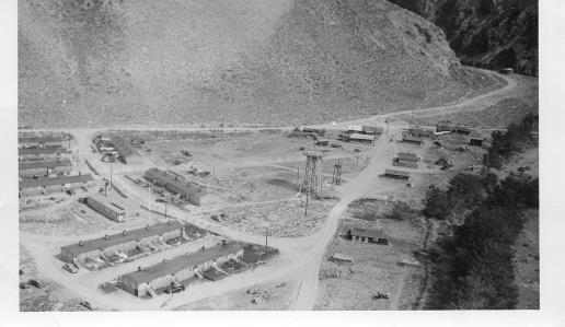
Aerial view of Pattterson in 1950’s. New town site on the left and old town site on the right. Patterson canyon is upper right |
|
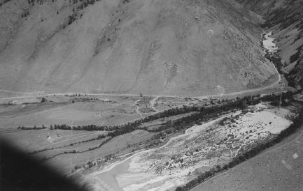
Aerial view. Town site is in the center and the white area on lower right is the tailings pond. Upper right corner looks up Patterson canyon and the white area is also tailings from the early years. |
|
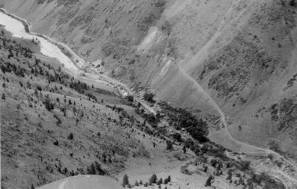
Aerial view of the mine site. The mill is right of the tailings pond and the main mine site area is in the middle. A rough access road goes up to the main mine portal. |
|
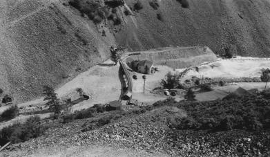
View from near the main portal looking down on the mill in the middle right. The white guest house is in the middle and tailings on the right. The guest house burned down and was not rebuilt. The mill burned down and was rebuilt and began operation in December 1948. |
|
Aerial photo’s of the townsite and the mine |
|
MENU CLICK ON ANY LINE BELOW TO VIEW THE CONTENTS
Aerial Photo’s
|